In today’s tech-driven world, the ability to visualize data spatially has been vital for various industries. Enter ArcGIS, a Geographic Information System (GIS) developed by ESRI, which is here to help us solve our client’s needs. Let’s chart our way into the world of ArcGIS and how it empowers businesses to harness the full capabilities of today’s mapping software.
Overview
At its core, ArcGIS is a comprehensive mapping solution that enables you to deliver a high quality experience for your users. It integrates various geographic data sets, allows users to overlay layers, analyze spatial relationships and extract meaningful insights. The user-friendly features and wide array of capabilities differentiates ArcGIS from competitors.
Standard Features
ArcGIS offers a plethora of map features designed to level up your user’s experience. Basic features such as customizable basemap tiles, display the user’s location in real-time and intuitive pan and zoom functions all makes map navigation a smooth and familiar experience.
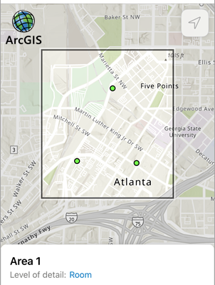
However, the true power of ArcGIS lies in its ability to visualize and interact with objects on a map. Custom-styled map markers with the same look and feel of pre-existing symbols, enables users to identify and track objects just as they’re used to seeing them. And if you have many objects in close proximity to one another? Group them together with “clusters” that can break apart or regroup at specific zoom levels.
Advanced Features
By providing methods to display object details or toggle visibility based on predefined groups, ArcGIS gives businesses the power to streamline asset management. And that just scratches the surface of the advanced features available!
With ArcGIS, you can draw on the map to indicate an area, or even let your users draw on the map themselves. You can apply a “highlight” styling on visible objects that meet a criteria. You can search for objects with a multitude of filters, such as object type, any custom attributes (defined and set by your organization’s data management team), or even search for objects within a defined geographical boundary.
The limit of its applications is your imagination.
Offline Maps
But what happens when you’re off the grid? Won’t we lose all of these convenient features? Fear not, as ArcGIS enables continued productivity even in offline environments.
By downloading map sections for offline use, users can still access critical data and functionalities without internet connectivity, a feature especially useful for your on-the-go users.
If storage space is a concern, you can decide which data points for objects are downloaded. So if your users just need to see the symbols on the map, you can omit the attributes data to cut down on payload sizes.
In conclusion, ArcGIS stands as one of the leaders in mapping technology, empowering businesses to unlock new opportunities. From basic map features to advanced asset management capabilities, ArcGIS is more than just a mapping solution—it’s a gateway to spatial intelligence. So, embrace the power of ArcGIS and chart your path to success in the digital age!
For more information about Perficient’s Mobile Solutions expertise, subscribe to our blog or contact our Mobile Solutions team today!