article thumbnail

Vibrant Planet raises $17M seed round to grow forest restoration SaaS

TechCrunch

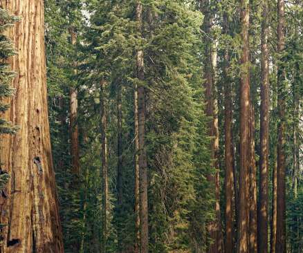
Lidar is incredibly helpful when it comes to mapping forests in 3D and determining their fire risk, but it’s not a panacea. Dense forests, which often represent the greatest fire risk, are hard to map from top to bottom, so the team has trained a machine-learning algorithm to fill in any gaps.

article thumbnail

Data Labeling in Machine Learning: Process, Types, and Best Practices

Altexsoft

When people hear about artificial intelligence, deep learning, and machine learning , many think of movie-like robots that resemble or even outperform human intelligence. Others believe that such machines simply consume information and learn from it by themselves. Well… It’s kind of far from the truth.

Insiders

Sign Up for our Newsletter

This site is protected by reCAPTCHA and the Google Privacy Policy and Terms of Service apply.

Trending Sources

article thumbnail

Computer vision transforms tennis coaching at Billie Jean King Cup

CIO

Other sports have been quick to embrace the use of data and analytics to transform how athletes are recruited, trained, and prepped for competitions, how they adjust to changing circumstances during play, and how they break down successes and failures after competition. Digital Transformation, Machine Learning, Machine Vision

Coaching 247
article thumbnail

Hire Metaverse Developers: Everything You Need to Know

Mobilunity

By utilizing cutting-edge technologies such as 3D, AR, and VR, metaverse app development creates a vast virtual platform that mimics the real world, allowing for a seamless and uninterrupted experience regardless of the number of users. What is Metaverse The metaverse has brought the future closer to reality through digitization?

article thumbnail

GIS Development Services

Mobilunity

into meaningful inputs using open-source GIS platforms, such as Autodesk Civil 3D software (geo-coordinates). 3D GIS services and modeling. Ukrainian salaries are provided based on Mobilunity’s Recruitment Team research on the local job markets. GIS database design. Technologies and Tools Used by GIS Developers.

article thumbnail

The wave of data in oceans

Capgemini

Well, Capgemini and the Norwegian Institute of Marine Research have taken on the challenge to use machine learning and AI to read, analyze and interpret vast amounts of data collected hundreds of meters below sea level, thus gaining a better understanding of events and inner workings of the ocean’s mechanisms. So what’s the solution?

Data 52
article thumbnail

Hire GIS Developer. Tasks & Hiring Options

Mobilunity

They are often referred to as GeoAI applications that focus on either geospatial machine learning or geospatial deep learning. Another benefit of GRASS GIS is that it supports 2 and 3D restore and vector data. Ukrainian salaries are provided based on Mobilunity’s Recruitment Team research on the local job markets.